The Hopeworks Geographic Information Systems (GIS) team is on a roll! It has landed several large contracts in recent months, added staff by hiring a temporary project manager, and opened many new opportunities for young adults to build skills in geographic information system technology.
One of these contracts allows the GIS team to expand the scope of its work with the Pinelands Preservation Alliance (PPA), and take on two new projects. Each will have an impact not only on the 1.1 million acres Pinelands National Reserve, but also the 400,000_+ people who live within its boundaries, plus millions more who live nearby and look to the Reserve for recreational, ecological, and cultural activities.
Initially, the Pinelands Preservation Alliance reached out to Hopeworks GIS team and Disability Rights NJ to help with an initiative to make the hiking, swimming, camping, and other attractions in the Pinelands more accessible to individuals with disabilities. One challenge that presents itself to people with disabilities: simply getting there. Sight-impaired people who use ride services like Uber and Lyft can’t reach the trails to hike, for instance, because there are no addresses associated with the trails. Others who are sight-impaired and who can walk the trails with the help of guide dogs, said in public hearings that they also need information on what to expect on any particular trail. One way the GIS team is responding is by creating Google views of the trails, similar to the Google “street view” technology familiar to many. GIS technology is perfect for this, because it connects data to a map, not only showing where things are, but also describing what those things are like. Google views of the trails gives visual information that sighted individuals can use to describe to sight-impaired individuals what they can expect to encounter on each trail.
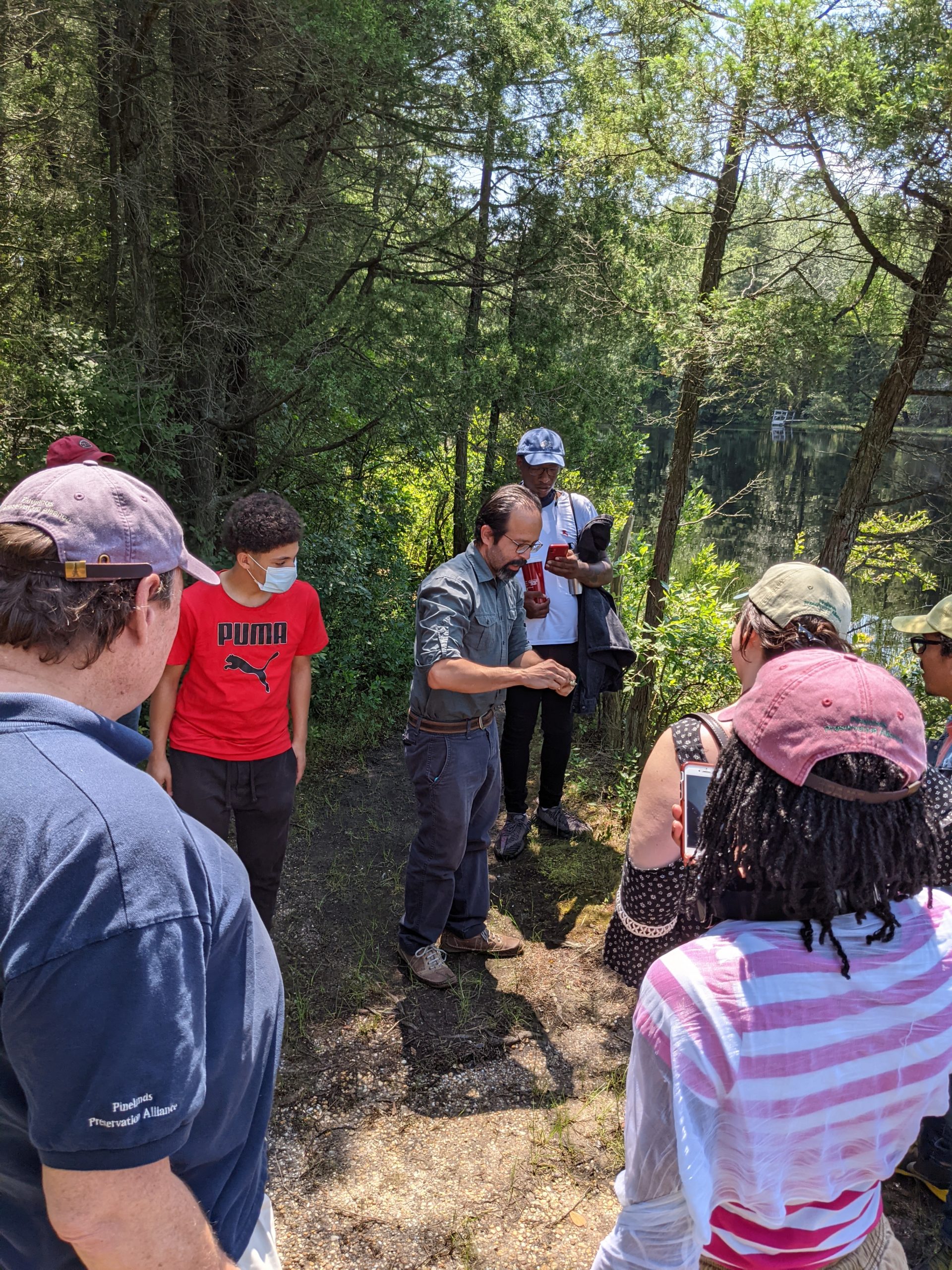
Luis Olivieri, GIS Director for Hopeworks, said the accessibility project will be ongoing through May. He noted that one hidden benefit of the project for Hopeworks young professionals is that it has gotten them out into nature and introduced them to the wonders of the Pine Barrens.
More recently, thanks to a generous grant from the William Penn Foundation, the Pinelands Preservation Alliance contracted with the Hopeworks GIS Team to undertake two additional projects. In one project, the GIS Team will help the PPA get a better handle on human diversity in the 56 municipalities connected with the preserve. (These communities span Atlantic, Burlington, Camden, and Cape May counties, plus a small part of Cumberland.County.) In the second project, the GIS team will survey the location of farms in the area, and provide information on the type of crops grown on the farms. The information will be useful for all the agencies involved in regional planning.
***
In other news, the Hopeworks GIS team has also taken on a major project with Virginia American Water that will help the company comply with environmental mandates. The multi-layer project is so large, Olivieri has had to expand the team beyond full-time staffer Leaundra McCullough, to ten more workers. Among them is Carlos “CJ” Pagan, who has been hired as a temporary project team leader. The project will conclude by year's end.
In this project, Hopeworks will scan more than 48,000 engineering drawings of the water system, and will enter the information into a database. That data will eventually become part of a geographical information system (GIS).The project will provide meaningful and instantly accessible information to VA American Water’s management and its field personnel.
At the project’s conclusion, VA American Water will have a better understanding of its system. For instance, company personnel will know where they have lead in their pipes. The company will also have much more comprehensive information on the “last part of their (underground) system,” says Olivieri, the part between the utility’s water valves and individual homes and businesses. In addition, the field workers will be able to access the information using a mobile device and get the precise coordinates for the underground valves, many of which are located under asphalt. While this may not seem like a big deal, it will save VA American Water a lot of time, and its customers major hassles when a part or parts of the underground water system break down. With this new technology in place, VA American Water will be able to pinpoint exactly where the problem is in their system, including inline valves, rather than spending hours locating the source of the problem (and having to turn off the water for its customers, or reroute traffic during the duration of the diagnostic and repair process.)
The VA American Water project is just the latest in a series of projects that Hopeworks GIS Team has taken on for American Water. Olivieri says the relationship between the two began “six years ago,” when NJ American Water partnered with the Hopeworks team and engaged it in a small project.
“It’s hard for a nonprofit organization in Camden working with young people to prove that we can provide a professional service,” says Olivieri.”We’re so lucky that NJ American Water wanted to give us the opportunity. We started with a small pilot project, and did so well, that pilot project grew to something bigger, and then to something even bigger than that,” says Olivieri. Since then, the Hopeworks GIS team has completed additional projects for American Water, including one in Tennessee and another in Pennsylvania.


